Are there interesting cultural resources in and around El Dorado Hills?
Cultural resources
Prehistoric resources in the EDH area include the following types:
- Sites with human burial remains
- Sites with animal remains
- Bedrock mortar stations, where Maidu and Miwok Indians processed food
- Midden sites containing cultural deposits or waste (items in these sites include glass and shell beads, buttons, stone tools, and arrowheads)
- Petroglyphs, or rock art
- Cupules, which are another form of rock art
Historic resources in the area include the following types:
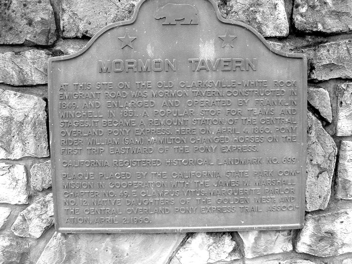
- State historic landmarks (SHLs), of which there is only one in the community: SHL699, marking the Mormon Tavern site, which was a popular stage stop in the Gold Rush period and a remount station for the Central Overland Pony Express.
- Reservoirs, including Bass Lake, which was created about 1895
- Wells, watering troughs, water storage tanks, ditches, and dams
- Historic paths and roads
- Mining complexes, artifacts, and debris, including the site of a stamp mill
- Cabins and other structures, both wood and stone
- Rancing complexes, including barns and other outbuildings, walls, fences, and corrals
- Rock cairns used as markers or monuments
- Cemeteries, including Clarksville, Tong, Hall/Richmond, and Mormon Island
- Household and other debris
Albert Fitch's shrine
The strange ruins, even in their currently decrepit state, continue to both charm and puzzle those who pass by them—walkers, bikers, and truck drivers taking a popular short-cut between the southern end of Silva Valley Boulevard, under Highway 50, and from there, on down White Rock Road.
What are those bathtub-like structures? They’re too small for summer water storage and too tall for livestock to drink out of.
And that fascinating curved stone structure with the decorations on the top. Wouldn’t it be worth saving? But what is it? A religious shrine? An elaborate marker for a hidden grave? A Halloween joke?
An article in the August 10, 1983 edition of the Mountain Democrat provides some answers about this collection of architectural oddments and its creator, Albert Fitch, son of George Clinton Fitch, one of Clarksville’s pioneers.
In 1856, George left Ohio and emigrated to California. The Fitches (including wife Mary (Wilson) and, eventually, several children) were among the earliest non-native Americans to settle in what was to become Clarksville. The Fitch family is related to many of the other Clarksville pioneer families; well-known names like Wilson, Fisk, Kyburz, Barton, and Tong.
According to the article, the land that George Fitch filed claim on covered 60 acres in an area then known as Buck’s Flat.
Mary died in 1871, leaving husband George and several children, including Albert, who was only about 8 years old at the time his mother died.
George died in 1904; Albert (who was also known as “Uncle Bert”) continued to live on the family ranch.
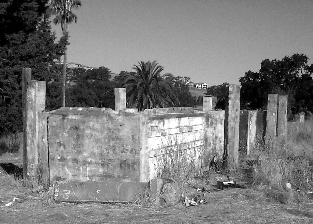
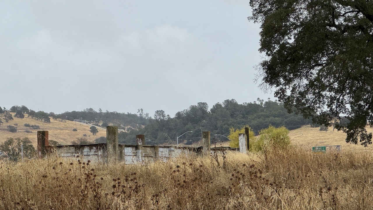
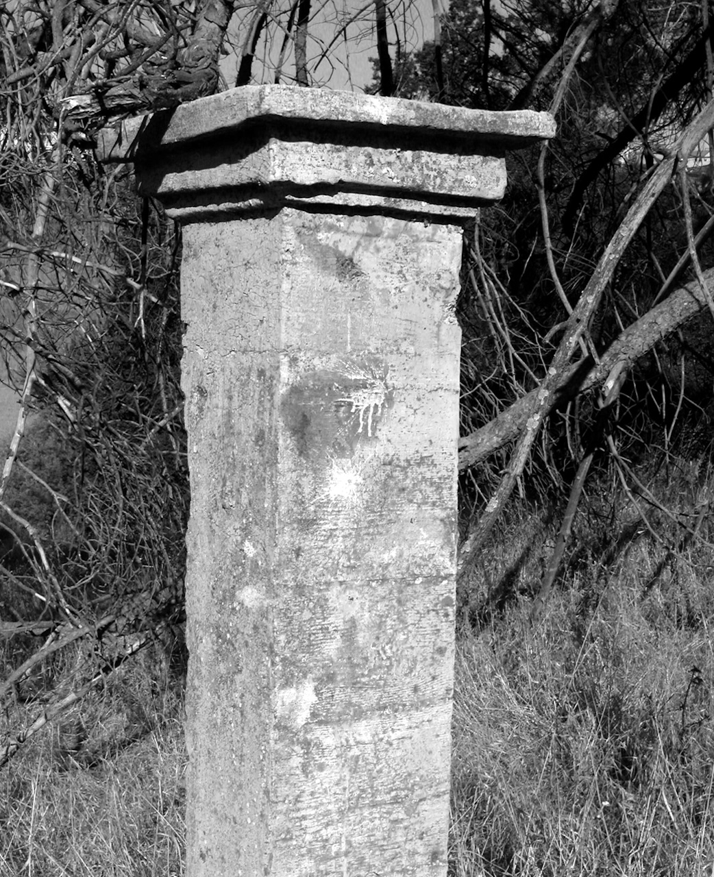
Around 1930, Albert began a project that must have occupied much of his free time over the next 20 years: A self-contained garden complex that surrounded the ranch house. He marked out the whole area with green and red stucco pillars and connected them with pipes. He built square cement “baths,” perhaps to hold the water needed to keep his vegetation fresh. Windmills pumped water to the gardens, which was an unusual botanic collection of non-natives, including several species of palm trees and some unusual types of pines. Some of the cement structures had artistic designs drawn into them.
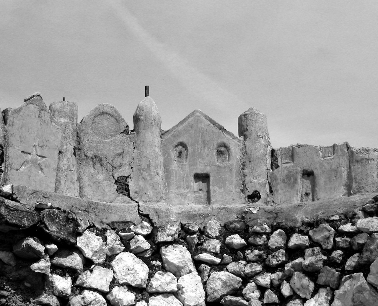
The most striking piece was a “shrine” consisting of a massive wall of stone crowned with a facade of what appears to be a miniature Mexican village. The tub at the base of the structure may have once been a fountain.
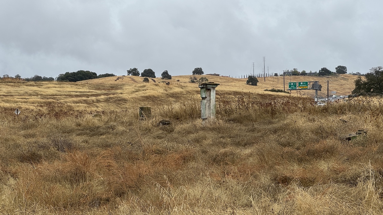
The garden seems to have thrived for many years, but in the early 1950s the ranch house burned to the ground, and the heat and flames ruined much of the garden, as well. Albert died a few years later, in 1955. He is buried in the Clarksville Cemetery.
After 50 years of weathering, neglect, and vandalism, all that remains of Albert’s dream garden are part of the shrine (the base of which now contains empty beer cans and burned tires), a few other stone structures, some pipes, a grove of trees, and a lot of trash, left by modern-day “pioneers.” The proposed completion of Silva Valley Parkway that allows access to White Rock under Highway 50, and that will later perhaps be expanded into a Silva Valley freeway interchange, may deliver the final blow to this fascinating little corner of El Dorado Hills.
For more information
Organizations listed in the following table have official responsibility for or a strong interest in cultural and environmental issues.
| Organization | Location | Responsibility or interest |
|---|---|---|
| Archeological Conservancy | Albuquerque, NM | Preserving architectural sites in the U.S. |
| California Office of Historic Preservation | Sacramento | Manages information in historical resources identified in California |
| El Dorado County Coroner (part of the Sheriff's Department) | Placerville | Human remains |
| El Dorado County General Services | Placerville | Cemeteries |
| North Central Information Center | California State University, Sacramento | Cultural resources in El Dorado County |