Geologic history
Geologic history of the western Sierra
Overview.
El Dorado Hills sits on the western slope of the Sierra Nevada at an elevation of 600 to 1,200 feet. The El Dorado Hills Post Office is at a latitude of 38 degrees 39 minutes north and a longitude of 121 degrees 4 minutes west.
Over many millions of years, the land around El Dorado Hills has been uplifted, bent, folded, and eroded to create the landscape we see today. The Sierra foothills were originally formed as part of a volcanic island chain in the sea, similar to the Hawaiian or Aleutian islands of today. The island chain was part of a tectonic plate geologists call the Faralon plate.
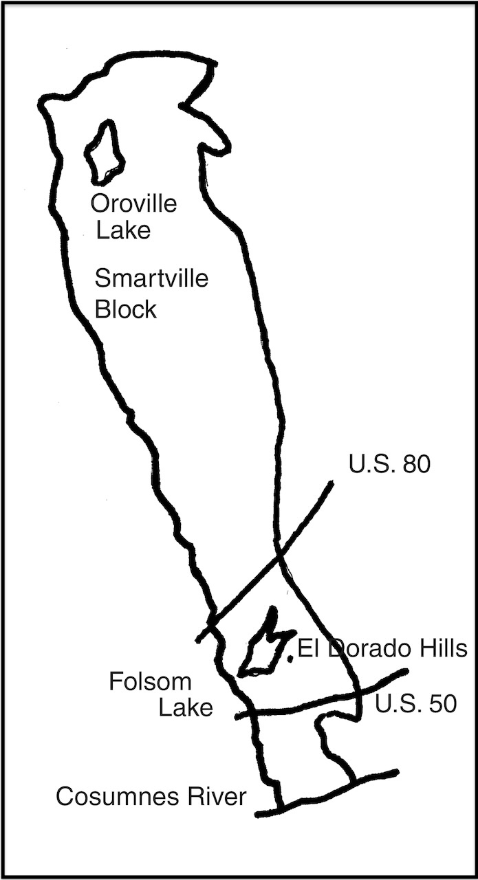
About 175 million years ago, the Faralon plate (moving west to east) collided with another tectonic plate that underlay the main part of what is now North America, called the North American plate. The area where the collision took place is a north-south line stretching from the Oroville Dam through El Dorado Hills to Sutter Creek.
Geologists refer to the El Dorado Hills' part of the western Sierra as the Smartville block or Smartville complex. Rocks in this area are characteristic of those that have had a volcanic origin and have since undergone physical and chemical changes.
Geologic timeline.
-
About 175 million years ago
The Faralon plate (containing a chain of volcanic islands) crashed into the North American plate and set in motion many geologic changes to the area that is now El Dorado Hills.
-
150-100 million years ago
A large inland sea covered what is now the Central Valley, the Coast Range, and the Sierra Nevada.
The Sierra was formed by the folding and buckling of the sedimentary rocks in the inland sea being pushed upward. The heat and pressure changed some of the sedimentary rocks into metamorphic rocks. Quartz sandstone became quartzite. Shale hardened into slate. Limestone recrystallized into marble. Igneous rocks cooling underground formed the granites found throughout the Sierra foothills. Other rocks metamorphosed into common local rocks like serpentine and greenstone.
Pressures from the magma pushing upward and shrinkage caused by the cooling granitic rocks resulted in cracks and fissures filled by solutions of quartz mixed with small amounts of gold, copper, lead, and other minerals
-
1848+
Gold seekers discovered valuable minerals on the surface or just below the surface of the creekbeds.
At first miners recovered gold nuggets and flakes by simply picking them up or panning for them. Over time, mining became more destructive and the miners caused significant environmental changes in the Sierra region. Examples include cutting of the forests and dredging of creekbeds that caused erosion and left cobbles and other debris in huge piles along the banks.
Glossary
The following table lists key terms used in this topic and their definitions.
| Term | Definition |
|---|---|
| Faralon plate | The tectonic plate that collided with the North American plate about 150 million years ago in the area now known as El Dorado Hills. |
| igneous rocks | Sometimes called volcanic rocks. Rocks that come from magma (molten or semi-molten rock) found deep in the earth. When magma cools beneath the surface, intrusive rocks are formed. Examples include granite and gabbro. Magma that reaches the surface forms extrusive rocks. Examples include lava, obsidian, and basalt. Igneous rocks are often associated with metal ores. |
| metamorphic rocks | Rocks that have been changed by heat, pressure, or permeation by other substances. Examples include marble, quartzite, and schists. |
| North American plate | The tectonic plate that collided with the Faralon plate about 150 million years ago in the area now known as El Dorado Hills. |
| sedimentary rocks | Rocks made of minerals that have been moved from their place of origin to another place of deposition. They are generally extremely varied, differing greatly in texture, color, and composition. Examples include sandstone, shale, and limestone. |
| Smartville block | Also known as the Smartville complex. The area of the western Sierra where the Faralon tectonic plate collided with the North American plate about 175 million years ago. |
| tectonic plate | A segment of the earth’s outer rind, the lithosphere, which extends down to a depth of about 60 to 100 miles. A dozen or more plates of various sizes now move about on the earth’s surface. |